![]()
![]()
The word « Trächelchen » is the nick-name of the word « Trach » meaning watering place in Luxembourgish.
At this location numerous sources have their origins. The different springs flow together to become the Aalbach (or Senninger-Bach), crossing the village of Senningen before flowing into the river Syre. Because of the huge water amount and the steepness of its way, many mills were situated on the banks of the Senningerbach. Because of its paper mills, Senningen was famous, even beyond the national borders, as an important centre of paper production.
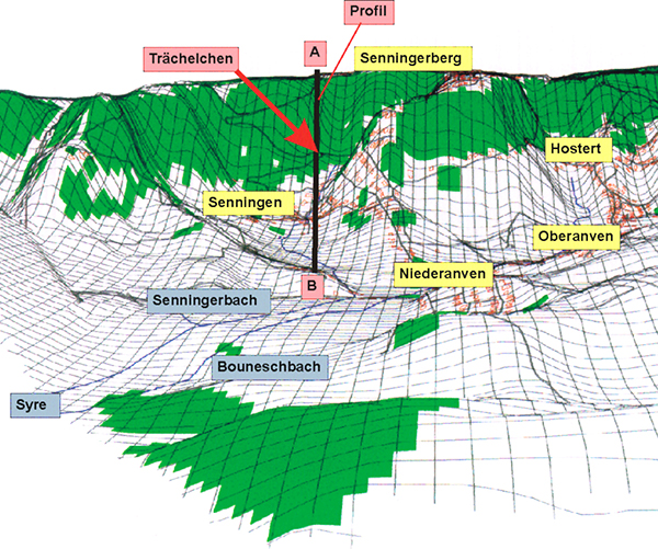
The origins of the sources.
The different spring waters are coming together to form the brook of Senningerbach.
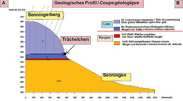
The springs at the “Trächelchen” erupt on the edge of the Luxembourg Sandstone layer. The surface of this layer is subject of an intense erosion and crumble away into loose sands.
Because of its porous and permeable surface the Luxembourg Sandstone layer is a perfect water carrier, facilitating the infiltration of rain waters to be led to the undergrounds.
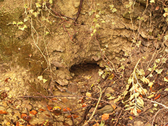 At the contact point of the sandstone layer with the impervious clay layers of Psilonotis (li1), the water infiltration is blocked and at the surface the springs are erupting, just as at the “Trächelchen”.
The Luxembourg Sandstone Layer as a drinking water reservoir.
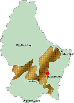
The spreading of the Luxembourg Sandstone layer
Luxembourg has an average rainfall rate of 2 billion cube meters per year. Nearly 55% of these waters are directly evaporating at the ground, 41% flow out on surface and only 4% can penetrate into the grounds to supply the phreatic water sheet.
The major part of the rain runoffs (60 – 65 millions of cube meters) are penetrating the Luxembourg Sandstone Layer, spreading over a surface of 493 square km. But only 300 square km of this surface are permeable, the others are covered by impervious clay and lime layers.
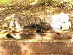
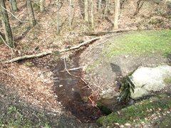
Spring waters drawn off at the watering place.
The water, coming from the phreatic water sheet of the sandstone layer is covering 90% of the national drinking water supply (2/3 of our drinking water comes from the phreatic water sheet and 1/3 from surface waters.)
The waters are captured in the sandstone layer for only a period of 6 to 12 months, so that a constant renewing of the phreatic water sheet is possible.
![]()
![]()