![]()
![]()
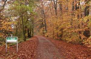
The cycling trail Luxembourg-Echternach is mainly situated on the old “Charly” railway line.
Since ever the Grünewald forest is crossed by a network of paths and roads. The very same path you are standing on now has also a very rich historic background. At the beginning it has been a roman road, then later the railway line for the “Charly” train and today it has been transformed into a national cycling trail. The ancient Roman road called “Kiem” in Luxembourgish, lead from Reims to Trier. It came from the actual Kirchberg (near the highway to Luxembourg-Trier) and crossed the Grünewald up to Senningerberg (near the new water tank). On its way it is partly still very well preserved. It continued its line near the actual “rue des Romains” to Niederanven via Mensdorf. Hostert had been connected to this “main road” by a “secondary road”. Another secondary road connected Oetrange and Altrier (Schanz) and crossed the Senningerberg (called main road) near the new water tank site. From Senningerberg to Waldhof this road had once been called “Heedwee”. The “Killwee”, crossing the Grünewald from North to South is also dated back to Roman times.
The Roman road called “Kiem”
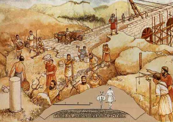 After Germania had been conquered and integrated in the Roman Empire, the Roman soldiers began to construct roads with the help of slaves and the population. The important connection Reims-Arlon-Trier had been constructed around the year 44 p.Chr. Many similar roads were used for military purposes, allowing to the Roman army to transport more efficiently its legions and military equipment.
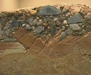
Profile of a Roman road.
For strategically important or city roads the Romans used stone pavement. Before the construction the terrain had to get cleared on a width of 60 m on both sides of the line. All the trees or bushes were stubbed in order to minimize the possibility of eventual hold-ups. The road was slightly cambered so that the rain water could easily be evacuated into a lateral trench. An average roman road was always wide enough for 6 soldiers to march one beside the other. This same width also allowed 2 vehicles to pass at the same time without any problem.
Along these Roman roads there had been set up a strong network of watchtowers with always very clear views over the surrounding region. The former presence of such towers is proved in Arlon, on the “Tossenberg” , on the “Marché aux Poissons” in Luxembourg City, on Senningerberg and on the “Widdeberg”.
“Charly”
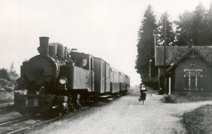 The narrow railway line, in service from 1904 until 1954 was also crossing the Grünewald. This line with a length of 45.8 km was used to transport persons and goods. The construction and keeping of this line allowed the local population to find work and bread. After the abandonment of the line, the rails had been taken away and today the old track is mainly used as part of the national cycling trail going from Luxembourg-City to Echternach.
Main road crossings in the Grünewald
 |
 |
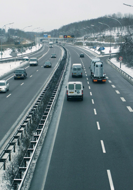
| With the construction of the highway Luxembour-Trier in 1970, between Weimershof and Sennigerberg the South part of the Grünewald (4500 ha) had been separated from the rest of the wooden area. The highway cuts through the Grünewald from North to South. | |
![]()
![]()