![]()
![]()
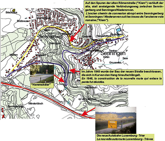
The “Haremskéier” is a very narrow bend on the road between Senningen and Senningen/Niederanven.
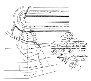
In the “Haremskéier” several landslides did damage the riverside residents‘plot of land. The map shows the extent of the landslide damage, happening in the year 1861. The concerned landowners had all been reimbursed.
The construction of that road had been decided in 1848. Until that day the gradient of 100 metres between the top and the edge of the Luxembourg sandstone plateau could only be passed by a very steep path, connecting directly Senningerberg with Senningen/Niederanven, all by following the old roman road (the “Kiem”) between Reims and Trier. This way has now been replaced by a longer road (the “route de Trèves”) with more bends but with less steepness.
With this street, adapting itself at the slope by meanders, the connection between Luxembourg and Trier had considerably been improved.
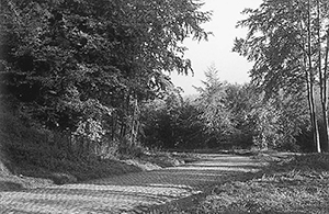
The old steep path, connecting Senningerberg with Senningen/Niederanven, is following the line of the old roman road (the “Kiem”).
The planting of chestnut trees, in whose shade, horses and people could rest, had positively enhanced the image of the streets in Senningen/Niederanven. Apart from the traffic improvement, the construction of this road also brought an economical highlight: many unemployed from the old paper mill in Senningen could find a job by helping to construct this road. Later a highway was built at the south end of this road, passing over the gradient between plateau and plain by a long and straight slope. This highway, with it’s over regional importance, finally entailed a real traffic relief for Senningen, Niederanven and Senningerberg and saved these villages from a permanent transit.
![]()
![]()