![]()
![]()
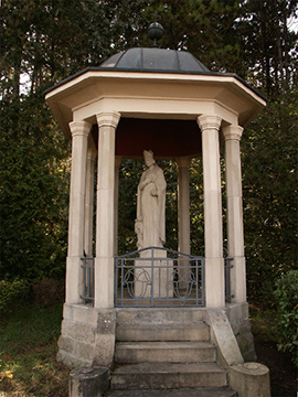 The St.Martin’s monument reminds us of a former pre-Christian event happening at the location “Hellegesteen” (meaning holy stone). he small round building, similar to a little temple, is situated at the bottom of the Senningerberg on the “rue des Romains”, an old Roman road, leading from Treves to Luxembourg. The open column circle allows a glimpse on the stone statue depicting St. Martin. On a cubic pedestal beside the figurine of the bishop is represented a little angel. The sculptor’s (the priest Joseph Bertrang) inscription is in Latin and refers to St. Martin’s journey to Niederanven in the year 384.
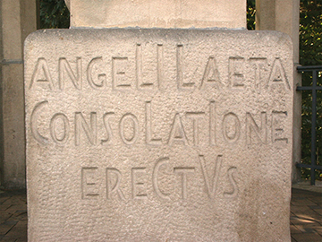
Inscription on the pedestal of the monument St Martin
The legend saying that an angel did encourage the suffering saint: “Sanctus Martinus afflictus angeli laeta Consolatione aerectus Consolectvrafflictos”, meaning: St. Martin had been comforted in his pain by an angel to comfort the distressed.On the site of the monument, sanctified in the year 1931, there had been a small chapel until the 17th century. The altar block had been transferred to the chapel of Senningen and for the following decencies a simple wooden crucifix marked the holy site.
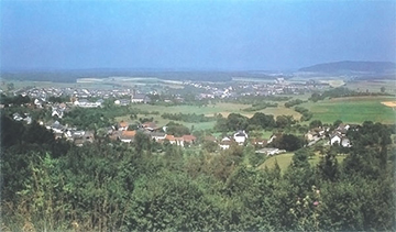
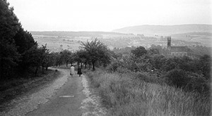
View from the “Hellegesteen”
From the “Hellegesteen” you have a beautiful view over the landscape. Historical pictures show the old view on Senningen and Niederanven and the steep afferent “rue du Kiem”.
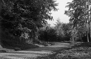
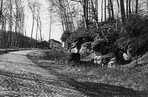
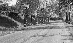
The old steep connection road between Senningerberg and Senningen, partly still with its cobblestones pavement.
This old connection between Senningerberg and Niederanven was already integrated into the Roman road network. The old “Kieme” (meaning paths) were part of a fortification system, allowing to the Roman soldiers to transport effectively their baggage and war material.
 |
 |
The “Kiem” coming from Arlon, crossed the actual City of Luxembourg and Pfaffenthal, continued over the “Weimershof” and lead on its way up to the actual highway on the Senningerberg. From there it steeply went down into the valley of Senningen and Niederanven.
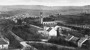
Old view from the “Hellegesteen” on the “rue du Kiem” and Niederanven
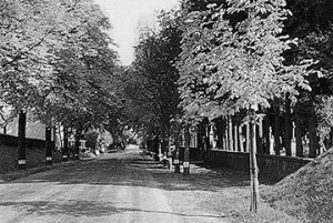
Later on a new connection road between Senningen and Niederanven was then constructed as an alternative to the old steep way. The new “route de Trèves”, also running along the slope to Senningerberg, allows with its serpentines a longer but easier trip than before. A splendid row of chestnut trees had been set up on both sides of the road, spending an effective protection from sun and rain to the old transporters and their horses.
 |
 |
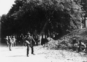 |
Chestnut Avenue — During the World War II some trees had been felled by German soldiers in order to slow down the American advance. After the war the trees had been replaced.
![]()
![]()