![]()
![]()
Situated at a height of 367m, this site offers an extraordinary view on the south side of the traditional Niederanven landscape- geologically characterised by the presence of the sandstone layer and Keuper, engendering different types of ground needing adapted use. 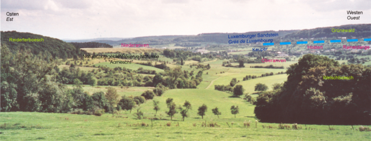 On the west side, the Luxembourg sandstone layer is marked by a 80 m high step in the terrain. Huge rock faces are characteristic for the Keuper landscape. The sandy and very light grounds of the sandstone layer are covered by the “Grünewald” forest, which by its surface of 4.500 ha, is the largest forest area in Luxembourg. Classified historic monument in the year 1966, the Grünewald is the most important reserve of drinking water and is also an important leisure and resting area. On the east side, on the Keuper layers, lays a wide and open landscape, marked by different attractive elements as small woodlands, orchards, shrub lands and arid grasslands. Since ever the inhabitants used this terraced landscape for pasture. At the beginning of the 19th century, even some vineyards could be found on the south slopes of the Aarnescht, particularly favourable for viticulture. In spite of the proximity to the city of Luxembourg, the landscapes of the Niederanven could perpetuate and preserve their rural character.
![]()
![]()